In This Article
- Introduction: Why Canada is a Motorcycle Rider's Dream
- The Cabot Trail, Nova Scotia: Ocean Views and Coastal Curves
- Icefields Parkway, Alberta: Riding Through the Heart of the Rockies
- Sea-to-Sky Highway, British Columbia: From Ocean to Alpine
- The Trans-Canada Highway Through the Rockies: Epic Cross-Country Stretch
- Gaspé Peninsula, Quebec: Coastal Beauty and French Flair
- Riding the Canadian Badlands, Alberta: Unique Landscapes and Quiet Roads
- Essential Tips for Motorcycle Touring in Canada
- Final Thoughts: Start Planning Your Canadian Motorcycle Adventure
Introduction: Why Canada is a Motorcycle Rider's Dream
Canada is a country built on a scale that humbles the imagination. For motorcycle riders, that scale translates into something rare and precious: endless ribbons of asphalt that cut through some of the most dramatic landscapes on Earth. From the salt-sprayed cliffs of the Atlantic coast to the glacier-carved valleys of the Rocky Mountains, the best motorcycle roads in Canada offer a riding experience that feels less like a journey and more like a pilgrimage. In 2026, with improved road surfaces, better rider services, and a growing network of motorcycle-friendly communities, there has never been a better time to point your front wheel north.
What makes Canadian riding truly special is the variety. One day you can be leaning into a tight coastal switchback with the ocean roaring below you. The next, you might be cruising past turquoise alpine lakes while snow-capped peaks tower overhead. The country does not offer just one signature ride. It offers dozens, each with its own personality, its own rhythm, and its own set of rewards. Riders who crave technical cornering will find it. Riders who prefer long, sweeping vistas will find those too. And riders who simply want to disappear into the wilderness for hours at a time will discover that Canada is one of the last places in North America where that is still possible.
Practicality matters as much as beauty, and Canada delivers here as well. The Trans-Canada Highway provides a reliable backbone, but the real magic happens on the secondary roads that branch off from it. Many of these routes are well-maintained, lightly trafficked, and clearly signed. Fuel stops can be spaced far apart in remote areas, which rewards a bit of planning, but that same remoteness means you will often have the road to yourself. For riders coming from the United States or overseas, border crossings are straightforward, motorcycle insurance is generally easy to arrange, and the riding season runs from late May through early October in most regions.
One of the joys of riding in Canada is the sense of space. You can ride for an hour without seeing a traffic light. You can pull over at a scenic lookout and hear nothing but wind and the ticking of your cooling engine. Small towns welcome riders with genuine warmth, offering hearty food, clean motels, and local knowledge about the road ahead. Fuel up when you can, carry layers for changing mountain weather, and be ready for wildlife. Moose, deer, elk, and bears are part of the landscape, especially at dawn and dusk. Ride accordingly, and the experience will be unforgettable.
The best motorcycle roads in Canada are not just about the pavement. They are about the moments between the corners: the fishing village where you stop for chowder, the mountain pass where you pull over to photograph a glacier, the quiet campground where you fall asleep to the sound of a river. These roads reward curiosity. They invite you to slow down, to look around, and to remember why you started riding in the first place. Whether you have a week or a month, Canada offers a riding adventure that will stay with you long after you park the bike.
In this guide, we focus on two of the country's most iconic routes: the Cabot Trail in Nova Scotia and the Icefields Parkway in Alberta. Each one represents a different face of Canadian riding. One is a coastal masterpiece of curves and ocean views. The other is a high-altitude corridor through the heart of the Rockies. Together, they show why Canada deserves a top spot on every rider's bucket list for 2026.
The Cabot Trail, Nova Scotia: Ocean Views and Coastal Curves
The Cabot Trail is not just a road. It is a 298-kilometer loop that wraps around the northern tip of Cape Breton Island like a ribbon of asphalt laid across a landscape of cliffs, forests, and fishing villages. For many riders, it is the single best motorcycle road in eastern North America. The route climbs and falls through the Cape Breton Highlands, hugging the coastline so closely in places that you can smell the salt air and hear the waves crashing against the rocks below. Every turn reveals a new postcard view, and the road itself is a constant invitation to lean, accelerate, and smile.
The Trail can be ridden in either direction, but most experienced riders recommend traveling counterclockwise, starting from Baddeck and heading up the east coast before crossing the highlands and returning along the west side. This direction puts you on the ocean side of the road for much of the route, which means unobstructed views and easier pull-offs for photos. The pavement is generally in good condition, though sections through Cape Breton Highlands National Park can be patched and uneven after winter. A park pass is required for the portion inside the national park, and it is worth every dollar.
The riding here is technical in the best possible way. Tight switchbacks climb from sea level to over 450 meters in a matter of minutes. The famous MacKenzie River and French Mountain sections offer a sequence of hairpins that demand focus and reward smooth throttle control. The descents are just as thrilling, with long sightlines down to the water and sweeping corners that carry you through forested valleys. Traffic is light outside of July and August, but even in peak season, the flow is manageable. Watch for RVs on the steep grades, and give yourself extra room on blind corners.
Weather on the Cabot Trail can change quickly. Fog rolls in off the Atlantic without warning, and the highlands can be ten degrees cooler than the coastal villages. Carry a good waterproof layer, and be prepared for reduced visibility on the summit sections. Wind is another factor, especially on the exposed western coast. A stable bike and relaxed grip will help you manage gusts that funnel through the valleys. Despite these challenges, the Cabot Trail is endlessly rewarding, and many riders complete the loop in a single long day before returning to ride it again at a slower pace.
Must-See Stops Along the Cabot Trail
The Cabot Trail is packed with places worth pulling over for. Start in Baddeck, the unofficial gateway to the route, where the Alexander Graham Bell National Historic Site offers a fascinating look at the inventor's life and work. From there, head north toward Ingonish, where you will find sandy beaches and the start of the highlands. The Keltic Lodge at Middle Head is a stunning spot for a photo, perched on a narrow peninsula with ocean on both sides.
Inside the national park, stop at the lookouts on French Mountain and North Mountain. The views down to the Gulf of St. Lawrence are breathtaking. Further along, the village of Chéticamp on the west coast is the heart of Acadian culture, with colorful houses, live music, and some of the best seafood on the island. Do not miss the sunset from the harbor, where fishing boats bob against a backdrop of red cliffs and green hills.
Best Time to Ride and Road Conditions
The ideal riding window for the Cabot Trail runs from mid-June through late September. July and August bring the warmest temperatures and the most reliable weather, but also the most traffic. June and September offer quieter roads and spectacular fall color beginning in late September. The highlands can be cold even in summer, so pack layers and expect fog near the coast.
Road conditions are generally good, but the route includes steep grades, sharp curves, and occasional rough patches. Construction is common in early summer as crews repair winter damage. Check the Nova Scotia road conditions website before you go. Fuel is available in Baddeck, Ingonish, and Chéticamp, but stations can be sparse in between, so top up whenever you can. Cell service is limited in the highlands, so download offline maps in advance.
Where to Stay and Eat on Your Ride
Baddeck is the most convenient base for starting and ending your loop, with a range of motels, inns, and B&Bs. The Telegraph House and the Inverary Resort are rider-friendly options with easy parking. On the east side, Ingonish offers cabins and lodges close to the park entrance. On the west side, Chéticamp has several cozy guesthouses and the popular Pilot Whale Chalets.
For food, do not leave without trying the seafood. The Rusty Anchor in Pleasant Bay serves excellent fish and chips with a view of the harbor. In Chéticamp, L'Abri Café and Restaurant offers Acadian specialties like rappie pie and fresh lobster. Many riders also stop at the Clucking Hen Café near North Shore for breakfast and baked goods. Portions are generous, prices are fair, and the hospitality is genuine everywhere along the Trail.
Icefields Parkway, Alberta: Riding Through the Heart of the Rockies
The Icefields Parkway, also known as Highway 93 North, is one of the most spectacular mountain roads on the planet. Stretching 232 kilometers between Lake Louise and Jasper, this route cuts through the heart of the Canadian Rockies, passing more than one hundred glaciers, countless waterfalls, and some of the most iconic peaks in North America. For motorcycle riders, it is a bucket-list experience that delivers mile after mile of sweeping curves, dramatic elevation changes, and scenery so overwhelming that you will find yourself pulling over again and again just to take it all in.
Unlike the tight, technical corners of the Cabot Trail, the Icefields Parkway is a road of flow. The curves are long and graceful, following the contours of the mountains and the valley floor. The pavement is generally smooth and well-maintained, with generous sightlines that invite you to carry speed through the bends. The speed limit is 90 km/h in most sections, but the real pace is set by the landscape. You will want to ride slowly enough to absorb the views, yet quickly enough to feel the rhythm of the road. It is a balance that makes this route endlessly satisfying.
The Parkway is a national park road, which means a Parks Canada pass is required. The pass can be purchased at the entrance gates or online, and it covers both Banff and Jasper National Parks. The road is open year-round, but for motorcyclists the season runs from late May through early October. Snow can fall at high elevations even in summer, and the Columbia Icefield area often has snowbanks lingering into June. Check the forecast and road reports before you ride, and be prepared for sudden temperature drops, especially at the higher passes.
One of the unique aspects of riding the Icefields Parkway is the sheer concentration of natural wonders. You do not need to detour to find them. They are right beside the road: Peyto Lake, Bow Lake, the Weeping Wall, the Athabasca Glacier, Sunwapta Falls, and Athabasca Falls. Each one is signed and accessible via short walks from the pull-offs. The Parkway can be ridden in three to four hours without stops, but most riders take a full day or more. The temptation to stop is constant, and the light changes the look of the mountains hour by hour.
Key Attractions and Scenic Pull-offs
Start at Lake Louise, where the turquoise water and the Victoria Glacier create one of the most photographed scenes in Canada. From there, head north and stop at Herbert Lake for a quiet moment before the crowds. Bow Lake and Peyto Lake are must-sees, with Peyto's wolf-head shape visible from a short uphill walk to the viewpoint. The Weeping Wall is a towering cliff face where waterfalls stream down in summer, and the Big Bend offers a dramatic hairpin with views of the entire valley.
At the Columbia Icefield, you can walk to the toe of the Athabasca Glacier or book a guided tour onto the ice. Further north, Tangle Falls and Sunwapta Falls are quick, rewarding stops. End your ride at Athabasca Falls near Jasper, where the river thunders through a narrow limestone gorge. Each stop adds depth to the journey, and the Parkway rewards those who take their time.
Wildlife and Safety Tips
Wildlife is abundant along the Icefields Parkway, and encounters are common. Elk, bighorn sheep, mountain goats, and black bears are frequently seen near the road. Grizzly bears are present but more elusive. Always stay on your bike or inside your vehicle when viewing animals, and never feed them. Keep a safe distance of at least 30 meters from elk and sheep, and 100 meters from bears. If an animal is on the road, slow down and wait for it to move. Do not honk or rev your engine.
Ride defensively, especially at dawn and dusk when animals are most active. Use your high beams when there is no oncoming traffic, and scan the shoulders constantly. The Parkway has no streetlights, so avoid riding after dark if possible. Cell service is patchy, so carry a paper map or download offline maps. Carry water, snacks, and a basic tool kit. The nearest help can be an hour away, so self-sufficiency is key.
Fuel and Services Along the Route
Fuel is the biggest logistical consideration on the Icefields Parkway. There are only two fuel stops along the route itself: one at Saskatchewan River Crossing and one at the Columbia Icefield Discovery Centre. Both are seasonal and can be expensive. Fill up in Lake Louise or Jasper before you start, and top up whenever you pass an open station. Carrying a small fuel canister is a smart precaution for riders with limited range.
Food and accommodations are also limited. Saskatchewan River Crossing has a basic restaurant and store, and the Icefield Centre offers cafeteria-style meals. For a more comfortable stay, plan to spend the night in Lake Louise or Jasper, where you will find a full range of hotels, campgrounds, and restaurants. The towns are busy in summer, so book ahead. The Parkway itself has several campgrounds, but they fill quickly and offer no services beyond basic facilities. Plan your fuel, food, and lodging before you set out, and the ride will be pure pleasure.

Sea-to-Sky Highway, British Columbia: From Ocean to Alpine
If you only have time for one ride in British Columbia, make it the Sea-to-Sky Highway. This legendary stretch of Highway 99 runs roughly 120 kilometers from Horseshoe Bay near Vancouver to the alpine village of Whistler, delivering one of the most dramatic transitions in Canadian motorcycling. You start at the edge of the Pacific Ocean, where salt air and ferry horns frame the first few kilometers, then climb through coastal rainforest, past granite cliffs, and into the high peaks of the Coast Mountains. It is not the longest ride on this list, but it packs more scenery per kilometer than almost any other road in the country.
The road itself is a rider's playground. Sweeping corners open up along Howe Sound, offering unobstructed views of deep blue water and forested islands. As you gain elevation, the curves tighten and the landscape shifts from ocean to mountain. The pavement is generally excellent, with wide lanes and well-engineered corners that invite a spirited but safe pace. For riders who love the combination of technical turns and jaw-dropping vistas, this is a must-ride in 2026.
Plan for a full day if you want to stop often, and you will want to stop often. The viewpoints are numerous, and each one seems to outdo the last. Even on a cloudy day, the moody atmosphere of low clouds clinging to the peaks creates a cinematic ride. On a clear day, the contrast between turquoise water and snow-dusted summits is almost overwhelming.
Highlights: Squamish, Whistler, and Beyond
Squamish sits roughly halfway between Vancouver and Whistler and makes a natural first stop. Known as the outdoor adventure capital of Canada, it offers excellent coffee shops, breweries, and a relaxed mountain-town vibe. The Stawamus Chief, a massive granite monolith, towers over the town and provides a stunning backdrop for a mid-morning break.
- Pull into the Sea to Sky Gondola parking lot for a quick photo stop even if you do not ride the gondola itself.
- Grab a coffee and a pastry at a local café on Cleveland Avenue before continuing north.
- Top up your fuel in Squamish, as services become less frequent as you approach Whistler.
Whistler is the crown jewel at the end of the highway. The village is pedestrian-friendly, filled with restaurants, shops, and mountain views in every direction. For motorcyclists, the ride through Whistler does not have to end in the village. Continue north on Highway 99 toward Pemberton for another 30 kilometers of quieter, equally scenic road. The stretch past Green Lake and through the narrow valley north of Whistler is less trafficked and offers a more relaxed pace with sweeping views of the river and farmland.
If you have time, ride a few kilometers up the Callaghan Valley Road just south of Whistler. It is a quiet detour that leads to Alexander Falls and gives you a taste of the backcountry without committing to a gravel adventure. The road is paved and well-maintained for the first several kilometers, making it an easy add-on.
Road Conditions and Traffic Considerations
The Sea-to-Sky Highway underwent a major upgrade before the 2010 Winter Olympics, and the result is one of the best-engineered roads in western Canada. Most of the route features wide shoulders, smooth asphalt, and excellent sightlines through corners. That said, this is a busy corridor, especially on summer weekends and holiday Mondays. Expect a steady stream of cars, RVs, and tour buses from late morning through late afternoon.
- Ride early on a weekday morning for the least traffic and the best light on Howe Sound.
- Watch for sudden slowdowns near viewpoints and trailheads, where drivers brake unexpectedly.
- Be prepared for changing weather; temperatures can drop noticeably as you climb toward Whistler.
- Watch for wildlife, particularly deer near dawn and dusk in the sections north of Squamish.
Road construction is an ongoing reality in British Columbia. Check DriveBC before you set out for any scheduled closures or single-lane alternating traffic. In 2026, several improvement projects are expected along the corridor, so a quick check in the morning can save you a long wait. The highway is generally rideable from late March through early November, but snow can fall at higher elevations as early as October. For the best conditions, plan your ride between May and September.
Side Trips and Alternative Routes
The Sea-to-Sky is the main event, but several side roads reward riders with extra time. One of the best is the short detour to Porteau Cove Provincial Park, a waterfront pullout about 20 minutes north of Horseshoe Bay. The park offers a pebble beach, a historic pier, and a stunning view back toward the islands of Howe Sound. It is a quick stop but one of the most photographed spots on the entire route.
Another worthwhile detour is the road to Britannia Beach and the Britannia Mine Museum. The turnoff is well marked, and the road drops down to the old mining community along the water. Even if you skip the museum, the ride down and back adds a fun, twisty section to your day.
For riders looking to extend the journey into a loop, consider returning to Vancouver via the Duffey Lake Road, which connects Pemberton to Lillooet. This is a more remote, technical ride with tighter corners and less traffic. It adds several hours to your day and is best suited to experienced riders who are comfortable with a more challenging road. The payoff is a raw, wild landscape that feels a world away from the polished Sea-to-Sky corridor.
The Trans-Canada Highway Through the Rockies: Epic Cross-Country Stretch
The Trans-Canada Highway is one of the longest national highways in the world, but the section that matters most to motorcyclists is the stretch through the Canadian Rockies. Running from Banff in Alberta through Yoho, Glacier, and Mount Revelstoke national parks to Revelstoke and beyond, this is a ride that defines the phrase "epic cross-country stretch." It is not just a road; it is a corridor through some of the most dramatic mountain scenery on the planet. For riders planning a 2026 adventure, this section of Highway 1 deserves a top spot on the itinerary.
What makes this stretch so special is the constant presence of the mountains. They are not distant backdrops; they rise directly from the roadside, their peaks often snow-covered even in midsummer. The road follows river valleys, climbs over high passes, and tunnels through solid rock. Every few kilometers brings a new vista, a new curve, or a new reason to pull over and simply stare. It is the kind of ride that reminds you why you ride a motorcycle in the first place.
Best Sections for Motorcyclists
The stretch from Banff to Lake Louise is the most famous, and for good reason. The road is smooth, wide, and framed by the jagged peaks of the Bow Valley. Mount Rundle and Cascade Mountain dominate the early kilometers, while the approach to Lake Louise offers sweeping curves and frequent wildlife sightings. This section is heavily traveled, so ride it early in the morning to avoid the tour bus rush and catch the mountains in soft morning light.
West of Lake Louise, the highway climbs over the Continental Divide and enters British Columbia through Kicking Horse Pass. This is a highlight for many riders. The descent toward Field and Golden is steep and winding, with runaway lanes and tight switchbacks that demand full attention. It is a thrilling section, but one that requires respect. The views of the Kicking Horse River far below are spectacular, and the engineering of the road itself is impressive.
Past Golden, the highway enters Glacier National Park and the Rogers Pass. This is the most remote and dramatic part of the ride. The road climbs high into the Selkirk Mountains, passing through snow sheds and avalanche zones. The scenery is raw and powerful, with glaciers visible from the road in several places. The visitor center at Rogers Pass is worth a stop, both for the history and for the sweeping view of the surrounding peaks.
From Revelstoke west, the highway follows the Eagle River through a lush, green valley. The mountains soften slightly here, but the riding remains excellent, with long sweepers and lighter traffic. Many riders choose to end their day in Revelstoke, a friendly mountain town with great food and a laid-back atmosphere. It makes an ideal base for exploring the surrounding roads or simply resting after a long day in the saddle.
Planning Your Multi-Day Ride
A multi-day ride through the Rockies requires more planning than a quick day trip, but the rewards are immense. Start by deciding on your direction. Riding west from Calgary to Vancouver follows the classic route and gives you the most dramatic reveal of the mountains. Riding east offers a different perspective, with the peaks rising behind you as you descend into the foothills of Alberta.
- Book accommodations well in advance for summer 2026, especially in Banff, Lake Louise, and Revelstoke.
- Expect mountain weather to change quickly; carry waterproof gear and warm layers even in July.
- Fuel up in Banff, Lake Louise, Golden, and Revelstoke, as services are limited between towns.
- Purchase a parks pass if you plan to stop in the national parks, as it is required for all vehicles.
Allow at least two full days for the section between Banff and Revelstoke if you want to stop and enjoy the viewpoints. Three days is even better, giving you time to explore side roads and hike to a few lookouts. The road itself can be ridden in a single long day, but you would miss the essence of the experience.
For an unforgettable loop, consider riding from Calgary to Banff, then west to Revelstoke, south through the Okanagan Valley, and back east through the Crowsnest Pass. This adds several days but takes you through an entirely different landscape of lakes, vineyards, and rolling ranchland. It is one of the best multi-day motorcycle routes in western Canada.
Gaspé Peninsula, Quebec: Coastal Beauty and French Flair
The Gaspé Peninsula juts into the Gulf of St. Lawrence like a finger pointing toward the Atlantic, and the road that circles it is one of the best-kept secrets in Canadian motorcycling. Here, the best motorcycle roads in Canada take on a distinctly European character, with French-speaking villages, historic lighthouses, and a coastline that shifts from sandy beaches to sheer cliffs. It is a ride that feels far removed from the rest of North America, both in landscape and in culture.
The route follows the St. Lawrence River and Gulf for most of its length, meaning the water is almost always in view. Small fishing villages appear every few kilometers, each with its own church spire, café, and harbor. The pace of life is slow, and the riding reflects that. You will not find aggressive switchbacks or high-speed sweepers here. Instead, you will find a gentle, rolling road that invites you to relax, breathe, and take in the scenery. For riders who value atmosphere and culture as much as pure riding dynamics, the Gaspé is a dream.
The Gaspé Loop: Route Overview
The classic Gaspé loop starts and ends in the city of Rimouski or the town of Matane, both on the south shore of the St. Lawrence. From there, Route 132 traces the coastline around the entire peninsula, covering roughly 900 kilometers in total. Most riders take three to five days to complete the loop, allowing time for stops, photos, and the occasional long lunch overlooking the water.
- Day one: Matane to Sainte-Anne-des-Monts, with stops at Cap-Chat and its famous wind farm.
- Day two: Sainte-Anne-des-Monts to Gaspé, crossing the interior through the Chic-Choc Mountains.
- Day three: Gaspé to Percé, with a visit to the famous Percé Rock and Bonaventure Island.
- Day four: Percé to Carleton-sur-Mer, following the Baie des Chaleurs with its warm water beaches.
The section along the north shore is the most rugged, with the road hugging the coast and the mountains rising steeply on the inland side. The stretch from Sainte-Anne-des-Monts to Gaspé climbs through the interior, offering a completely different feel with forested hills and river valleys. The south shore along the Baie des Chaleurs is the warmest and most relaxed, with small towns and sandy beaches that invite a swim on a hot day.
Cultural Stops and Local Cuisine
The Gaspé Peninsula is not just a ride; it is a cultural journey. The region is proudly Francophone, and even a basic grasp of French greetings will open doors and earn smiles. The villages are filled with artisan shops, seafood counters, and bakeries producing some of the best croissants outside of France. Take your time here. The joy of this ride is as much about the stops as the road between them.
- Sample fresh seafood at a roadside canteen, especially lobster, snow crab, and smoked salmon.
- Visit the Musée de la Gaspésie in Gaspé for a deeper understanding of the region's history.
- Stop at a fromagerie to taste local cheeses, many made in small batches on family farms.
- Try poutine with a Gaspé twist, often topped with local seafood or smoked meat.
Percé is the most famous stop on the loop, and for good reason. The massive limestone arch of Percé Rock rises from the sea just offshore, creating one of the most iconic views in eastern Canada. Take a boat tour to Bonaventure Island to see the northern gannet colony, one of the largest in the world. The island is a national park, and the sight of thousands of white seabirds nesting on the red cliffs is unforgettable.
The Gaspé Peninsula rewards riders who are willing to slow down and embrace the local rhythm. It is not a road for setting speed records or chasing adrenaline. It is a road for long days, good food, and the simple pleasure of following the coast wherever it leads. For a 2026 riding season that includes something truly different, point your front wheel east and discover the quiet magic of the Gaspé.
Riding the Canadian Badlands, Alberta: Unique Landscapes and Quiet Roads
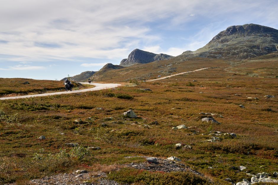
When riders talk about the best motorcycle roads in Canada, the conversation usually drifts toward the Rocky Mountains. But east of the Rockies lies a landscape that feels like another planet. The Canadian Badlands of Alberta offer a completely different kind of riding experience. Here, the roads stretch across rolling prairie, dip into dramatic river valleys, and wind through coulees carved by ancient glaciers. The terrain is open, the traffic is light, and the sky seems to go on forever.
What makes this region special for motorcyclists is the sense of solitude. You can ride for an hour and pass only a handful of vehicles. The pavement is generally in good shape, and the long sightlines let you relax into a rhythm. You will not find tight switchbacks here, but you will find sweeping curves, sudden elevation changes, and views that stop you in your tracks. The Badlands reward riders who appreciate wide-open spaces and geological drama over technical cornering.
The riding season runs from late May through September, with July and August offering the most reliable weather. Summer temperatures can climb into the high 20s Celsius, so early morning rides are a smart choice. The wind can be strong across the open prairie, so be prepared for crosswinds, especially on east-west roads. A windscreen and a relaxed grip on the bars will make your day much more comfortable. Fuel stops are spaced out, so plan your range carefully and top up whenever you can.
Dinosaur Trail and Hoodoos
The Dinosaur Trail is the crown jewel of Badlands riding. This loop takes you through Drumheller, a town built around paleontology, and along the Red Deer River where the valley walls reveal 70 million years of history. The road climbs out of the valley and onto the prairie, then drops back down again, giving you a constantly changing perspective. The north section of the loop includes a short ferry crossing on the Bleriot Ferry, a fun novelty that adds character to the ride.
Along the trail, you will encounter the hoodoos. These slender rock spires, capped with harder stone, rise from the valley floor like natural sculptures. There is a designated hoodoo viewing area with parking, and it is worth the short stop. Walk among the formations, take photos, and appreciate the scale of erosion that shaped this landscape. The light is best in the late afternoon, when the sandstone glows orange and red.
The Dinosaur Trail is roughly 48 kilometres in total, but give yourself at least two hours to complete it with stops. The road surface is paved throughout, though some sections are narrow with no shoulder. Watch for RVs and tourist vehicles, especially near the Royal Tyrrell Museum. This museum is one of the best dinosaur museums in the world and makes an excellent midday break. Park the bike, cool off inside, and learn about the creatures that once roamed this valley. The contrast between the air-conditioned galleries and the hot, dusty road outside is part of the experience.
Small-Town Charm and Services
The towns scattered through the Badlands are more than just fuel stops. They are genuine communities with character, history, and surprisingly good food. Drumheller is the largest and offers the most services, including motorcycle-friendly parking, several restaurants, and a couple of hotels. The giant dinosaur statue in the centre of town is a classic photo opportunity. Do not be too cool to stop for a picture.
Rosebud, a tiny hamlet southwest of Drumheller, is worth a detour. It is known for its theatre school and quiet, tree-lined streets. The Rosebud Cafe serves home-style meals and fresh baking. It feels like stepping back in time. Further east, the town of Hanna offers fuel, a grocery store, and a chance to stretch your legs. These small towns may not have dealerships or dedicated motorcycle shops, so carry basic tools and a tire repair kit just in case.
Accommodations in the Badlands range from chain motels in Drumheller to rustic cabins and campgrounds. Many riders choose to base themselves in Drumheller for a couple of nights and do day loops from there. If you prefer quieter evenings, look for bed and breakfasts in the surrounding countryside. Book ahead in July and August, as the region attracts families and fossil hunters. The hospitality is warm, and locals are used to travellers passing through. A friendly chat at a gas station often leads to tips about roads you will not find on any map.
Essential Tips for Motorcycle Touring in Canada
Planning a motorcycle trip across Canada is different from riding in Europe or the United States. The distances are vast, the weather can shift dramatically, and services can be far apart. Knowing a few key things before you set out will make your ride safer and far more enjoyable. These tips apply whether you are chasing the best motorcycle roads in Canada on a sport tourer, an adventure bike, or a cruiser.
First, understand the scale of the country. Canada stretches across six time zones, and riding from one province to the next can take days. Do not overestimate how many kilometres you can comfortably cover in a day. A good average is 300 to 400 kilometres on scenic roads, less if you stop often for photos and meals. Build flexibility into your itinerary so you are not forced to ride in bad weather or after dark. Wildlife is most active at dawn and dusk, and hitting a deer or moose is a serious risk in many regions.
Second, carry cash and a physical map. Cell service is excellent in southern Canada, but it disappears quickly once you head north or into mountain valleys. A paper map or downloaded offline maps are essential backups. Small towns may not have ATMs, and some rural gas stations still do not accept credit cards. Having a couple hundred dollars in cash can save you from a stressful situation.
Third, check your insurance and roadside assistance coverage. Canadian provinces have different requirements, and if you are visiting from another country, your policy may not cover you the same way. Look into a motorcycle-specific roadside assistance plan that covers towing over long distances. A breakdown in northern Ontario or rural Saskatchewan can leave you stranded for a day or more if you are not prepared.
Packing for All Weather Conditions
Canadian weather is famously unpredictable, especially in the mountains and along the coasts. You can start a July morning in sunshine and end the afternoon in freezing rain. Packing layers is not optional. A good base layer, a mid-layer for warmth, and a waterproof outer shell will handle most conditions. Look for gear that packs small but performs well, like packable down jackets and rain suits that fit over your riding gear.
Waterproof gloves and boots make a huge difference. Cold, wet hands and feet will sap your energy and make riding miserable. Consider carrying a second pair of gloves so you can swap out wet ones. Heated grips are a worthwhile investment for Canadian touring, even in summer. Many riders also pack a neck gaiter or balaclava for cold mornings at higher elevations.
Do not forget sun protection. The sun is intense in Canada, even on cool days. Sunscreen, lip balm with SPF, and quality sunglasses are essentials. A hydration system or water bottle that you can access while riding helps you stay alert. Dehydration sneaks up on you, especially on long prairie stretches where the air is dry. Pack high-energy snacks like trail mix, jerky, and granola bars for days when towns are few and far between.
Understanding Canadian Road Rules
Road rules in Canada are set at the provincial level, so they vary slightly depending on where you ride. Speed limits are posted in kilometres per hour, not miles. Most rural highways have limits between 80 and 100 km/h, while major divided highways may allow up to 110 km/h. Speed enforcement is common, and fines can be steep. Watch for reduced speed zones in small towns and construction areas.
Lane filtering and lane splitting are not legal in any Canadian province. Motorcycles are expected to take a full lane position, just like a car. Passing is done on the left, and you should return to the right lane once you have completed the pass. In most provinces, you must ride with your headlight on at all times, even during the day. Many modern bikes do this automatically.
Helmet laws are universal in Canada. All riders and passengers must wear a certified motorcycle helmet. Some provinces also require eye protection. Impaired driving laws are extremely strict, with severe penalties including vehicle impoundment. If you plan to enjoy a drink, do it after the bike is parked for the night. Seatbelt laws do not apply to motorcycles, but wearing full protective gear is always the smart choice.
Booking Accommodations in Peak Season
Summer is short in Canada, and everyone wants to enjoy it. From late June through early September, hotels, motels, and campgrounds fill up quickly, especially in popular destinations like Banff, Jasper, and the Cabot Trail. If you are riding the best motorcycle roads in Canada during peak season, book your beds ahead of time. Waiting until late afternoon to find a room can leave you riding in the dark to the next town.
National and provincial park campgrounds often require reservations, and the best sites go months in advance. If you prefer camping, check the reservation windows for Parks Canada and provincial park systems. Many sites are reservable online. For motels and small inns, a phone call the morning of your arrival works well. The owners can tell you about road conditions and may hold a room for you.
Consider mixing accommodation styles. A few nights in a comfortable hotel can help you recover from long days in the saddle. Budget for higher prices in tourist hotspots. A basic motel room in a small town might cost under $150, while a hotel in Banff can easily exceed $400 in July. If you are on a budget, stay in smaller towns just outside the major parks. You will save money and often find quieter roads and friendlier service.
Final Thoughts: Start Planning Your Canadian Motorcycle Adventure
Canada is a country that rewards motorcyclists with staggering variety. One day you are carving through coastal curves with ocean spray in the air. The next, you are crossing a prairie so wide it feels like the horizon is a physical place. The best motorcycle roads in Canada are not just about the pavement. They are about the moments between the corners: the moose standing at the treeline, the small-town diner where the coffee is bottomless, the mountain pass that leaves you breathless at the summit.
The key to a successful Canadian ride is planning with room for spontaneity. Book your major stops, pack for every season, and leave space in your schedule for the unplanned detour. Some of the best memories come from roads you did not intend to ride. Talk to locals, ask about their favourite routes, and be willing to change your plans when someone says, "You have to see this."
Whether you have two weeks or two months, Canada will not disappoint. The riding season is short, but it is spectacular. Start mapping your route, check your gear, and get ready for an adventure that will stay with you long after the engine cools. The road is calling, and in 2026, there is no better time to answer.
Gear for this trip
- Motorcycle Rain Suit
- Waterproof Motorcycle Gloves
- Motorcycle Phone Mount
- Motorcycle Tool Kit
- Packable Down Jacket
As an Amazon Associate I earn from qualifying purchases.


No comments:
Post a Comment