
In This Article
- Why Dedicated Motorcycle Navigation Matters in 2026
- Top 10 Motorcycle GPS and Navigation Apps for 2026
- In-Depth Reviews: Features, Pricing, and User Experience
- How to Choose the Right Motorcycle GPS App for Your Riding Style
- Essential Features to Consider in 2026
- Mounting and Hardware: Getting the Most from Your GPS App
- Safety First: Using Navigation Responsibly on Two Wheels
- Future Trends: What’s Next for Motorcycle Navigation?
- Final Thoughts: Ride More, Stress Less
Why Dedicated Motorcycle Navigation Matters in 2026
Riding a motorcycle is fundamentally different from driving a car. You are exposed to the elements, you feel every curve, and your route choices define the entire experience. In 2026, the best motorcycle GPS and navigation apps understand this difference. They do not simply get you from point A to point B; they help you find the joy in the journey while keeping you safe and informed.
Standard car navigation often fails riders. It prioritizes highways, ignores elevation changes, and assumes you have a roof over your head. Dedicated motorcycle navigation flips that script. It prioritizes twisty roads, avoids gravel when you want pavement, and accounts for weather patterns that matter when you are leaning into a corner. The tools available in 2026 have reached a level of sophistication that makes riding smarter genuinely effortless.
Whether you are a daily commuter filtering through city traffic or an adventure rider crossing state lines, the right app can transform your ride. It can warn you about a hailstorm ahead, reroute you around a closed mountain pass, or simply suggest a detour that turns a boring straightaway into a memorable stretch of asphalt. Investing time in choosing the right navigation tool pays off every single time you twist the throttle.
The Evolution of Motorcycle GPS: From Paper Maps to AI-Powered Apps
Not long ago, motorcyclists relied on folded paper maps stuffed into tank bags. Those maps were bulky, hard to read at speed, and useless in the rain. The first dedicated motorcycle GPS units changed everything. They were rugged, waterproof, and glove-friendly, but they were also expensive and required constant manual updates.
Smartphones disrupted that market. Suddenly, riders had powerful computers in their pockets. Early navigation apps were clunky and drained batteries quickly. But by 2026, the best motorcycle GPS and navigation apps have evolved into AI-powered platforms that learn your riding style. They analyze your speed through corners, remember your favorite roads, and proactively suggest routes that match your preferences.
The shift from static maps to dynamic, intelligent routing is the biggest leap forward. Modern apps pull real-time data from traffic sensors, weather stations, and even other riders. They can predict where you will want to stop for fuel based on your tank range and riding habits. This is not just navigation; it is a co-pilot that understands why you ride.
Key Challenges Motorcyclists Face with Standard Navigation
Using a car navigation app on a motorcycle introduces several frustrating problems. The first is routing. Car apps prefer interstates and major highways because they are fastest for four-wheeled vehicles. For a motorcyclist, those roads are often boring, windy, and fatiguing. A route that is perfect for a sedan can be miserable on two wheels.
The second challenge is hardware integration. Car apps assume you have a large dashboard screen and a controlled cabin. On a motorcycle, you deal with glare, vibration, and touchscreens that do not work well with gloves. Many standard apps also lack audio prompts optimized for helmet headsets, making turn-by-turn directions hard to follow at speed.
Finally, there is the issue of offline access. Motorcyclists frequently ride through areas with no cell service. Mountain passes, rural backroads, and desert highways are exactly where standard streaming maps fail. A dedicated motorcycle app allows you to download entire regions for offline use, ensuring you never lose your way when the signal drops.
What to Look for in a Motorcycle GPS App
When evaluating the best motorcycle GPS and navigation apps for 2026, focus on a few non-negotiable features. Offline maps are essential. You need full route functionality without a data connection. Glove-friendly interfaces with large buttons and voice command support make a huge difference on the road.
Look for apps that offer motorcycle-specific routing. This means the ability to prioritize curvy roads, avoid highways, and set elevation preferences. Community features are also valuable. Apps that let you discover and share routes with other riders expand your riding horizons. Finally, consider battery efficiency and integration with your existing gear, such as Bluetooth headsets and handlebar mounts.
Top 10 Motorcycle GPS and Navigation Apps for 2026
The app stores are crowded with navigation tools, but only a handful truly serve motorcyclists. The following ten apps stand out in 2026 for their reliability, feature sets, and rider-focused design. Each one offers something unique, whether that is offline reliability, community-driven routes, or real-time traffic intelligence.
Choosing the right app depends on your riding style. A weekend canyon carver will prioritize curvy road discovery. An adventure rider needs robust offline topographical data. A daily commuter wants real-time traffic and speed trap alerts. This list covers every type of rider, from the casual weekend warrior to the long-distance iron butt.
Below you will find a quick overview of each app. The in-depth reviews that follow will break down the top contenders in greater detail, covering pricing, user experience, and specific strengths. Use this list as your starting point for finding the perfect digital riding companion.
1. Calimoto: The Ultimate Motorcycle Route Planner
Calimoto is purpose-built for motorcyclists who love twisty roads. Its routing algorithm prioritizes curves, elevation changes, and scenic byways over straight highways. You can set your desired level of "twistiness" and let the app build a round trip from your garage. Offline maps and turn-by-turn voice navigation make it a complete package for spirited riding.
2. REVER: Community-Driven Rides and Offline Maps
REVER combines a massive library of user-generated routes with powerful tracking tools. You can browse rides shared by other motorcyclists, download them for offline use, and record your own adventures. The social feed keeps you inspired, while the Butler Maps integration highlights legendary riding roads. It is a community hub as much as a navigation tool.
3. Waze: Real-Time Traffic, Crowdsourced Alerts
Waze excels at daily commuting and urban riding. Its real-time traffic updates and crowdsourced alerts for police, hazards, and road closures are unmatched. The motorcycle mode filters routes to be more two-wheel friendly, and the audio alerts work seamlessly with helmet headsets. It is not built for scenic touring, but for getting through traffic efficiently, Waze is king.
4. Google Maps: The All-Rounder with Motorcycle Mode
Google Maps remains a reliable default for millions of riders. Its motorcycle mode offers slightly optimized routing and lane guidance. The massive database of points of interest makes finding fuel, food, and lodging easy. Offline maps are available, though the interface is not as glove-friendly as dedicated motorcycle apps. Still, it is a solid backup and daily driver.
5. Apple Maps: Seamless Integration for iPhone Riders
Apple Maps has improved dramatically for motorcyclists. The clean interface works well with CarPlay and Apple Watch. Voice guidance through Siri is natural and hands-free. While it lacks dedicated twisty road routing, its integration with the Apple ecosystem makes it a convenient choice for iPhone users who want simple, reliable navigation without extra apps.
6. TomTom GO Navigation: Offline Reliability
TomTom has decades of GPS experience, and its GO Navigation app brings that expertise to smartphones. The offline maps are excellent, covering entire continents without a data connection. Speed camera alerts and lane guidance are precise. The interface is clean and easy to read at a glance, making it a strong choice for long-distance touring.
7. Sygic GPS Navigation: 3D Offline Maps
Sygic offers high-quality 3D offline maps stored directly on your device. The app includes head-up display projection, speed limit warnings, and dynamic lane guidance. For motorcyclists, the offline reliability is the main draw. You can navigate confidently through remote areas without worrying about data roaming or dead zones.
8. OsmAnd: Open-Source Power for Adventure Riders
OsmAnd is a favorite among adventure riders and off-road enthusiasts. It uses OpenStreetMap data, which often includes trails and paths missing from commercial maps. The app is highly customizable, with layers for topography, terrain, and points of interest. The learning curve is steeper, but the flexibility is unmatched for backcountry exploration.
9. Scenic: The Curvy Road Enthusiast's Choice
Scenic is designed specifically for riders who chase corners. Its curvy road algorithm lets you dial in exactly how much twist you want. The app offers round-trip generation, offline maps, and voice prompts. It is a focused tool that does one thing exceptionally well: finding the most enjoyable route between two points.
10. MyRoute-app: Advanced Trip Planning and Sharing
MyRoute-app is a powerful trip planning platform. It allows you to build detailed routes on your computer and sync them to your phone. The sharing features are excellent for group rides. You can export routes to other apps and devices, making it a versatile tool for serious route architects.
In-Depth Reviews: Features, Pricing, and User Experience
Now that you have seen the top ten list, it is time to dig deeper into the apps that matter most for specific riding scenarios. This section breaks down the features, pricing models, and real-world user experiences for the leading contenders. Understanding the nuances of each app will help you make an informed decision before you mount your phone to your handlebars.
Pricing models vary widely across these apps. Some operate on a freemium model with limited free features and paid subscriptions. Others require a one-time purchase for full offline access. Consider how often you ride and what features you truly need. A monthly subscription might be worth it for a daily commuter, while a weekend rider might prefer a one-time purchase.
User experience is equally important. An app with powerful features is useless if you cannot operate it safely while riding. Look for clean interfaces, large touch targets, and reliable voice guidance. The best apps minimize distraction and let you keep your eyes on the road while still providing the information you need.
Calimoto: Twisties, Round Trips, and Offline Maps
Calimoto earns its reputation as the ultimate motorcycle route planner through its singular focus on fun. The app's routing engine analyzes road curvature, elevation change, and speed limits to find the most engaging path. You can set a destination and let Calimoto build a route that maximizes twisties, or you can generate a round trip from your current location with a specified distance and direction.
The offline map functionality is robust. You can download entire regions and navigate without any cell service. This is crucial for riders exploring remote mountain roads where the best curves are found. Turn-by-turn voice guidance works with Bluetooth headsets, and the app displays speed limits and sharp curve warnings. The interface is designed to be glove-friendly, with large buttons and minimal clutter.
Pricing is subscription-based, with a free tier that limits route generation. The paid version unlocks unlimited round trips, offline maps, and advanced routing preferences. For riders who prioritize the joy of the ride over the speed of arrival, Calimoto is worth every penny. The community features, including shared routes and ride tracking, add extra value.
REVER: Route Library, Tracking, and Social Features
REVER positions itself as the social network for motorcyclists. The app hosts a massive library of routes contributed by riders around the world. You can search for rides near you, filter by difficulty and length, and download them for offline use. The Butler Maps integration highlights legendary motorcycle roads, adding a layer of curated quality to the community content.
Tracking is a core feature. REVER records your rides, including route, speed, and elevation profile. You can share your tracks with friends, compete on leaderboards, and build a personal log of your adventures. The tracking runs in the background, so you can focus on riding without fiddling with your phone. After the ride, you can review your stats and relive the highlights.
The app offers a free tier with basic tracking and a limited number of route downloads. The premium subscription unlocks unlimited offline maps, Butler Maps overlays, and advanced tracking features. For riders who love discovering new roads and sharing their journeys, REVER is an engaging and practical tool.
Waze vs Google Maps: Which Is Better for Daily Commutes?
For daily commuting and urban riding, Waze and Google Maps are the two heavyweights. Waze wins on real-time intelligence. Its crowdsourced alerts for police, speed cameras, accidents, and road hazards are incredibly accurate and timely. The community actively reports conditions, giving you a live view of the road ahead. Motorcycle mode filters routes to avoid difficult intersections and narrow streets.
Google Maps offers broader data and more reliable offline access. Its points of interest database is unmatched, making it easy to find fuel stations, restaurants, and repair shops. The motorcycle mode is less aggressive than Waze's, but still provides some route optimization. Google Maps also integrates better with other Google services, such as calendar events and saved places.
The choice depends on your priorities. If avoiding traffic jams and speed traps is your main concern, Waze is the better tool. If you want a reliable all-rounder with strong offline capabilities and a vast business database, Google Maps is the safer bet. Many riders run both, using Waze for the commute and Google Maps for everything else.
Offline Navigation Champions: TomTom, Sygic, and OsmAnd
When you ride beyond cell coverage, offline navigation becomes a necessity, not a luxury. TomTom GO Navigation, Sygic, and OsmAnd are the champions in this category. Each takes a different approach to storing maps on your device, but all three deliver reliable navigation without a data connection.
TomTom GO Navigation offers polished, professional-grade offline maps. The interface is clean and easy to read at a glance. Speed camera alerts and lane guidance are precise and dependable. TomTom's long history in GPS hardware translates into a software experience that feels refined and trustworthy. The subscription price is reasonable for the quality of the maps.
Sygic stands out for its 3D offline maps and head-up display projection. The visual quality is excellent, making complex intersections easier to understand. Sygic also includes speed limit warnings and dynamic lane guidance. For riders who want a premium visual experience without relying on data, Sygic is a strong choice.
OsmAnd is the open-source wildcard. It uses OpenStreetMap data, which often includes hiking trails, forest roads, and other paths missing from commercial maps. This makes it ideal for adventure riders exploring off the beaten path. The interface is less polished, and the learning curve is steeper, but the flexibility and depth of data are unmatched. OsmAnd is free to try, with paid plugins for advanced features.
How to Choose the Right Motorcycle GPS App for Your Riding Style
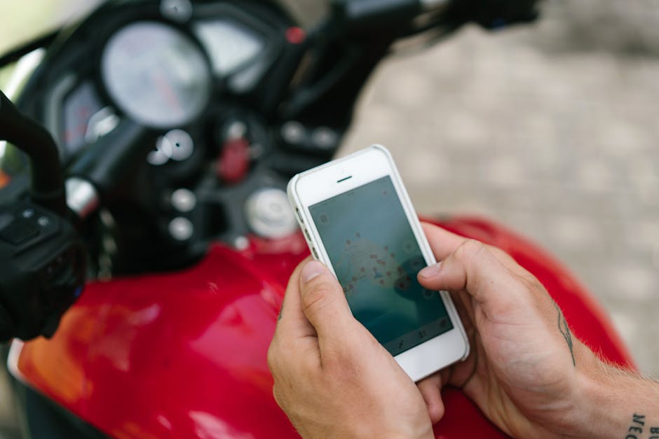
The best motorcycle GPS and navigation apps 2026 are not one-size-fits-all. A commuter slicing through city traffic has very different needs from a long-distance tourer crossing three state lines or an adventure rider hunting for unmarked forest service roads. Choosing the right tool starts with an honest look at how, where, and how often you ride. The right app should fade into the background so you can focus on the road, the scenery, and the ride itself.
Before downloading anything, think about your typical ride length, your tolerance for fiddling with settings, and whether you ride in areas with spotty cell coverage. Also consider your mounting setup. A phone in a waterproof case on your handlebars is the most common configuration, but some riders prefer audio-only navigation through a Bluetooth headset. The app you pick needs to work with your hardware, not against it.
Battery drain is another real-world factor. A navigation app running GPS, screen-on, and Bluetooth audio simultaneously will drain a phone quickly. Look for apps with efficient offline modes and dark themes designed for AMOLED screens. A dark map at night is easier on your eyes and your battery. Finally, consider the subscription model. Some apps charge a one-time fee, others require annual subscriptions for live features. Match the cost to how many months of the year you actually ride.
For Long-Distance Tourers: Offline Maps and Route Planning
Long-distance touring often means riding through mountain passes, rural farmland, and remote highways where cell service drops to zero. The best motorcycle GPS and navigation apps 2026 for tourers put offline reliability first. You need downloadable regions that cover every state or country on your route before you leave the driveway. A route that disappears when you lose signal is worse than no route at all.
Tourers also benefit from powerful pre-trip route planning on a desktop or tablet. Dragging a route across a phone screen is tedious when you are mapping 400-mile days. Look for apps that sync routes from a web planner to your phone. Waypoint support is essential: fuel stops, scenic overlooks, lunch spots, and hotel check-ins all need to be placed precisely. The ability to export and share GPX files adds flexibility if you ride with a group using different devices.
For Commuters: Real-Time Traffic and Voice Guidance
Daily commuters face a different set of problems. The route is familiar, but traffic, construction, and accidents change it every morning. Real-time traffic data with smart rerouting is the single most valuable feature for city and highway commuters. The app should proactively suggest faster alternatives before you sit in a jam. Crowdsourced incident reports from other drivers add another layer of awareness.
Voice guidance is also non-negotiable for commuters. Taking your eyes off the road in dense traffic is dangerous. Turn-by-turn prompts delivered through a helmet headset or earbuds keep your attention where it belongs. The voice should be clear, give early warnings, and pronounce street names correctly. Lane guidance for complex highway interchanges is a huge plus during rush hour. Commuter apps should also start up quickly and remember frequent destinations like work and home.
For Adventure and Off-Road Riders: Topographic and Trail Maps
Adventure riders need maps that show what is not on pavement. Standard navigation apps are useless on gravel roads, double-track trails, and single-track paths. The best motorcycle GPS and navigation apps 2026 for off-road use include topographic layers with elevation contours, public land boundaries, and trail networks. The ability to switch between street view, satellite view, and topo view is essential for scouting a route.
Off-road navigation also requires robust track recording. When you find an amazing unmarked trail, you want to save it and share it. Breadcrumb tracking shows exactly where you have been, which is critical when trails fork and signs are missing. Offline reliability is even more important off-road, where cell coverage is often nonexistent for days at a time.
Essential Features to Consider in 2026
Motorcycle navigation apps have matured significantly, and the best motorcycle GPS and navigation apps 2026 share a core set of features that separate serious tools from basic map viewers. Understanding these features helps you compare apps on equal footing. Not every feature matters to every rider, but you should know what you are paying for and what you are giving up when you choose one app over another.
The base feature set is table stakes now: turn-by-turn navigation, search, and saved places. What differentiates the top apps are motorcycle-specific refinements. These include routing algorithms that understand a motorcycle is not a car, weather awareness integrated directly into the route, and display options that work with gloves and bright sunlight. Think about which features solve a real problem on your rides.
Some features sound great in a marketing bullet list but add little in practice. A cluttered screen with too many data layers can distract more than it helps. The best apps let you customize the display aggressively, hiding everything except what you need at that moment. A clean, readable map at 70 miles per hour is a safety feature, not just a design preference.
Offline Maps and Downloadable Regions
Offline maps are the single most important feature for any rider who leaves urban areas. You cannot rely on cell coverage in the mountains, deserts, or rural backroads. The app should let you download entire states, provinces, or countries over Wi-Fi before your trip. Map updates should also work offline or queue until you are connected again. The map needs to include points of interest like gas stations and restaurants, not just roads.
Motorcycle-Specific Routing (Curvy Roads, Avoid Highways)
Motorcycle-specific routing transforms a navigation tool into a ride planner. The app should offer options to prioritize winding, scenic roads over straight highways. Look for a "curvy roads" toggle or a thrill factor slider. Equally important is the ability to avoid highways, tolls, and unpaved roads when you are on a street bike. The routing engine should understand that a twisty mountain pass is a feature, not a bug.
Voice Guidance and Helmet Audio Integration
Voice guidance keeps your eyes on the road. The app must work seamlessly with Bluetooth helmet headsets from brands like Cardo and Sena. Prompts should interrupt music or intercom audio cleanly and then resume. Volume should adjust automatically based on speed and wind noise. The best apps also support voice commands, so you can request a gas station or change a destination without stopping.
Weather Overlays and Road Condition Alerts
Weather is a safety issue on two wheels. Radar overlays show storms building along your route, giving you time to pull over or reroute. Temperature alerts warn of ice risk in mountain passes. Road condition alerts from transportation departments flag closures, construction, and debris. These live features require a data connection, but the best apps cache the last known conditions before you lose signal.
Trip Logging, Sharing, and Social Features
Half the fun of a great ride is sharing it. Trip logging records your route, distance, elevation, and speed for later review. One-tap sharing to riding communities or social media keeps your friends in the loop. Some apps include leaderboards or challenge badges for reaching destinations. These features should be optional and not drain battery or bandwidth in the background.
Mounting and Hardware: Getting the Most from Your GPS App
Even the best motorcycle GPS and navigation apps 2026 are useless on a dead phone bouncing in your pocket. Hardware choices matter as much as software choices. A solid mount, reliable power, and weather protection turn your phone into a true navigation device. Skimping on any of these three leads to frustration, lost navigation, or a broken phone on the side of the road.
Vibration is the silent killer of phone cameras. Motorcycle handlebar vibrations can destroy optical image stabilization systems over time. This is especially true on big twins and singles. A quality mount with vibration damping is not optional if you use your primary phone for navigation. Budget mounts transfer all that vibration directly to the phone, and the repair bill for a damaged camera far exceeds the cost of a good mount.
Power delivery is the second critical piece. A navigation app with the screen on will drain a battery in a few hours. A hardwired USB charger connected to your bike's battery keeps the phone topped up all day. Look for a charger with enough output to actually charge while navigating, not just slow the drain. A short, high-quality cable with a right-angle connector reduces stress on the port and keeps things tidy.
Weather protection rounds out the setup. Even on a sunny day, a sudden shower can soak an unprotected phone. A waterproof case or a mount with a built-in rain cover is essential for touring. Touchscreens become unreliable when wet, so choose gloves with conductive fingertips or a mount that allows for voice-first operation. Some riders add a small visor or shade to reduce glare and keep the screen readable in direct sunlight.

Safety First: Using Navigation Responsibly on Two Wheels
No matter how advanced the best motorcycle GPS and navigation apps 2026 have become, they are only as safe as the rider using them. A navigation app can guide you through unfamiliar mountain passes, but it cannot compensate for distracted riding. The golden rule remains simple: set your route before you twist the throttle, and never interact with a screen while moving.
Modern apps have built-in safeguards, but they only work if you enable them. Voice guidance should always be on, and it is worth investing in a quality Bluetooth headset so you hear prompts clearly without looking down. Many riders also use a handlebar-mounted phone case, but even then, glancing at a map for more than a split second at speed is a risk. If you need to make a change, pull over safely. A thirty-second stop is always faster than a hospital visit.
Glove-friendly interfaces matter more than most riders realize. The best motorcycle GPS and navigation apps 2026 all support large touch targets and simplified menus, but thick winter gloves can still cause mis-taps. Before a long trip, practice using the app with your actual riding gloves while stationary. Learn where the "cancel route" and "mute" buttons live so you can hit them by feel if needed.
Weather integration is another safety feature that is easy to overlook. Apps that overlay live radar or warn of incoming storms give you time to adjust your route or find shelter. Riding into a sudden downpour on a twisty road is dangerous, and navigation tools that anticipate weather shifts are worth their subscription cost. Check the forecast layer before you leave, and set alerts for severe conditions along your planned path.
Battery management is also a safety issue. A dead phone means no navigation, no emergency calls, and no way to share your location. Use a weatherproof, vibration-damped mount with built-in charging, and carry a compact power bank as backup. On longer rides, consider running the app in battery-saver mode or downloading offline maps so the screen and GPS do not drain power as quickly.
Route selection itself can be a safety tool. Many apps now let you choose "curvy roads" or "avoid highways," which is fun, but you should also filter for road surface quality and traffic density. A scenic gravel road might look appealing on the map, but if you are on a heavy touring bike with street tires, it becomes a hazard. Use the app's terrain view and read recent rider reviews of unfamiliar segments before committing.
Finally, share your live location with someone you trust. Several navigation apps include a "ride share" or "live tracking" feature that sends your position to a friend or family member. If you stop moving unexpectedly in a remote area, that person can check in or alert authorities. It takes two minutes to set up and could make all the difference on a solo ride through empty backcountry.
Future Trends: What’s Next for Motorcycle Navigation?
The pace of change in motorcycle navigation is accelerating quickly. What feels cutting-edge in 2026 will likely seem ordinary within a few years. The biggest shift on the horizon is deeper integration between navigation apps and the motorcycle itself. Newer bikes already feature built-in displays that mirror your phone, but the next step is two-way data sharing: the bike tells the app about fuel level, tire pressure, and engine temperature, and the app adjusts routing accordingly.
Imagine your navigation app automatically rerouting you to a gas station because your tank has forty miles of range left, or suggesting a break because your engine temperature is climbing in stop-and-go traffic. That is not science fiction. Several manufacturers are working on open protocols that let third-party apps read live vehicle data, and the best motorcycle GPS and navigation apps 2026 are already laying the groundwork with beta features.
Augmented reality is another trend gaining traction. While full heads-up displays built into helmets are still expensive and bulky, the technology is shrinking fast. Within a few years, expect lightweight visor overlays that project turn arrows and hazard warnings directly into your line of sight. For now, some apps offer an "AR preview" mode that uses your phone camera to show route overlays when you are walking or stopped, helping you visualize complex intersections before you ride through them.
Community-driven data is becoming more powerful too. Real-time reports of road closures, gravel, potholes, police presence, and even scenic viewpoints are now crowd-sourced by millions of riders. The next evolution is predictive routing that learns from historical traffic patterns, weather trends, and rider preferences to suggest routes you would genuinely enjoy, not just the fastest or shortest path. It is navigation that understands why you ride in the first place.
Voice control is also improving dramatically. Early voice assistants struggled with road noise and wind buffeting, but newer noise-canceling microphone arrays and on-device processing have made hands-free commands far more reliable. Soon, you will be able to say "find a coffee stop with outdoor seating in the next ten miles" and get an answer without ever touching a button. That is a genuine safety win for motorcyclists.
Offline capability is expanding as well. Instead of downloading a static map region, future apps will cache dynamic layers like live traffic, weather, and community alerts for offline use. Satellite imagery and 3D terrain models will become standard, giving you a much better sense of elevation changes and curve severity before you commit to a route. For adventure riders heading into areas with zero cell signal, this is a game-changer.
The final trend worth watching is subscription fatigue. Riders are tired of paying for five different services. Expect consolidation, where one app bundles navigation, weather, community alerts, ride tracking, and even insurance discounts into a single monthly fee. The winners in this space will be the apps that respect your time, your money, and your attention while delivering genuinely useful, rider-focused features.
Final Thoughts: Ride More, Stress Less
The whole point of motorcycle navigation is not to stare at a screen. It is to remove the mental load of "where am I going?" so you can focus on the ride itself. The best motorcycle GPS and navigation apps 2026 achieve that by being quiet when you do not need them and crystal clear when you do. They fade into the background, leaving you free to enjoy the road, the scenery, and the simple pleasure of moving through the world on two wheels.
Choosing the right app comes down to how you ride. A weekend canyon carver has different needs than a cross-country tourer or an off-road adventurer. The good news is that the current generation of apps is flexible enough to serve all three, often with a single subscription. Spend an afternoon testing a few options on routes you already know. See which interface feels natural, which voice prompts you actually hear, and which route suggestions match your instincts.
Do not overthink it. Start with one app, learn its quirks, and stick with it for a month. The real value comes from familiarity: knowing exactly what "turn left in five hundred feet" sounds like, trusting the rerouting logic, and understanding how the app handles missed turns. That confidence translates directly into safer, calmer riding.
And when the navigation works, something wonderful happens. You stop worrying about missing exits or finding gas stations. Your shoulders relax. Your eyes lift from the map to the horizon. You notice the way the light hits the hills and the smell of pine trees after a rain. That is the entire reason you ride. The technology is simply a tool to get you there more often, with less friction and more joy. So pick your app, plan a route you have never ridden, and go get a little lost on purpose. The road is waiting.
Gear for this trip
- Motorcycle Phone Mount with Vibration Dampener
- Bluetooth Helmet Headset Intercom
- Waterproof Motorcycle Phone Case
- Motorcycle USB Charger for Handlebar
As an Amazon Associate I earn from qualifying purchases.


No comments:
Post a Comment